We’ve just introduced CDXGeodata to expand our offering of location analytics software. CDXGeodata is a set of spreadsheets apps and web service APIs that work with a variety of software platforms including Windows, the Apple Mac and Linux. We’ve designed this product so it can be used by standard business professionals as well as programmers to develop custom desktop or web based applications. Currently our CDXZipStream and CDXStreamer products only work with Windows versions of Microsoft Excel. CDXGeodata dramatically expands this coverage
Our initial release includes API web services that support address correction, Zip and Zip+4 lookup, distance, lists and radius calculations. The CDXGeoData Web Services API uses REST (REpresentational State Transfer), which is used to build web services that are lightweight, easy to maintain, and scalable. We’ve also created a set of 7 Excel spreadsheet apps that work with these services. The apps automate bulk requests to the services and can create reports such as filtering an address list by radius distance and analyzing demographics within a radius. These templates have been designed to work both with Excel for the Mac and well as Excel for Windows. Just enter your key and paste in your data to get the reports you need.
CDXGeodata is not licensed on a per user basis like CDXZipStream. Any number of users can access the CDXGeodata service with a single API key. Tokens are used to access CDXGeoData with different levels for each service request. Simple requests may only require 1 token while more complex analysis like radius analysis will require more. A free account is available that supports up to 1000 tokens each month for development, evaluation and non-profit use. Additional requests can be purchased in blocks that start at $29.95 for 5000 requests. These tokens remain available for up to 1 year.
If you have one of our current products you might ask why you might need this service. Not all customers have every feature available and might need to do a one-time radius analysis or demographic report. CDXGeodata allows you to purchase this data at a much lower price when compared to upgrading your software. That being said, CDXZipStream and CDXStreamer provide an unlimited number of request for users who regularly produce such reports. You might also want to distribute a radius analysis to a wide variety of users in your company. CDXGeodata would allow you to produce a custom Excel template or intranet site that could be distributed without requiring any additional software to be deployed. Using CDXZipStream would require each user to own and install a license, CDXGeodata would not. You just pay for the number of token requests you need.
You can develop custom apps yourself using the geodata.cdxtech.com portal or contact us to do the work for you at customsolutions@cdxtech.com. If you are familiar with VBA, an excellent resource for developing with REST based services is to use a template called VBA-Web. Both the documentation and the template itself are available at the link given. The template is available for use under MIT license.
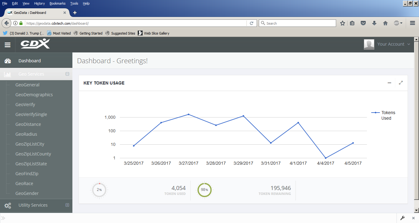
Both programmers and business users can also interface with the service thru a portal we’ve developed at geodata.cdxtech.com. You log in with your username (usually your email address) and the API key that received when setting up your account. With this portal you can track usage, create and download example reports and view programming examples in C#, Javascript and VB. Programming examples using the VBA-web template are also available at geodata.cdxtech.com.
Here is a screenshot of the portal interface.
We think that you will find CDXGeodata a powerful and flexible environment for all your location analytics needs. It’s free to get started with a development account so we encourage you to take advantage of the service.